Latitude Dependent Lunar Phase Shapes.
General Description of the Simulation
The orientation of the lunar phase shape to the horizon (i.e., the position angle of the lunar shape) can tell us about the observer's geographic latitude. Therefore, from the photo of the various lunar shapes, students can estimate the location (latitude) of the observer. This is a simple 3-D representation of the relative positioning of the Sun, Earth, Moon, and the location of the Observer.

Hemispheric dependency of lunar phase (figure from OpenEdu.com)
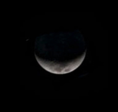
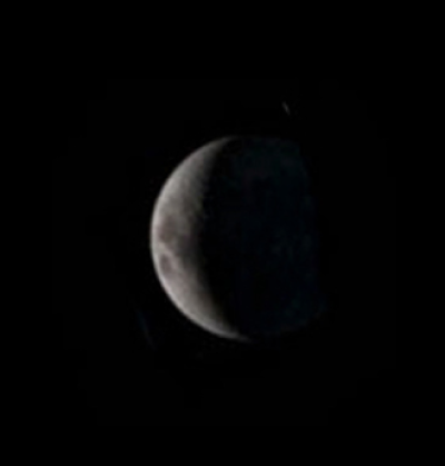
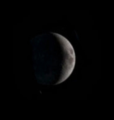
Waxing moon seen at different places on the Earth (Left: Equator, Middle: North Pole, Right: South Pole). Seasonal variation is ignored in this simple explanation. The left image was taken after the Sunset at the western horizon.
We can even mention about the liberation of the Moon in this topic.
Pending Tasks
Important pending tasks (or notes/ideas) to complete the simulation.
- Task 1
- Task 2
- …
Technical Aspects
Prerequisites
These are technical prerequisites (3D model components) to create this simulation.
- item 1
- …
Newly created components from this simulation
These are newly created components (functions, materials, cameras, etc.) from this topic simulation.
- New component 1
- …
Astro Concepts
These are underlying astronomical concepts to teach with this simulated topic.
- Concept 1
- …
Key Scenes
These are key scenes of the simulation; based on storyboard files.
- Scene 1
- …